The POP is a fixed building or cabinet in a very precise location rather than a general area, so mapping this is slightly different.
First access the Maps screen for the POP by clicking the blue Select button next to Geo Data.
A map with a red border denoting the POP-Location will appear with a cross-hair target to identify the POP like so:
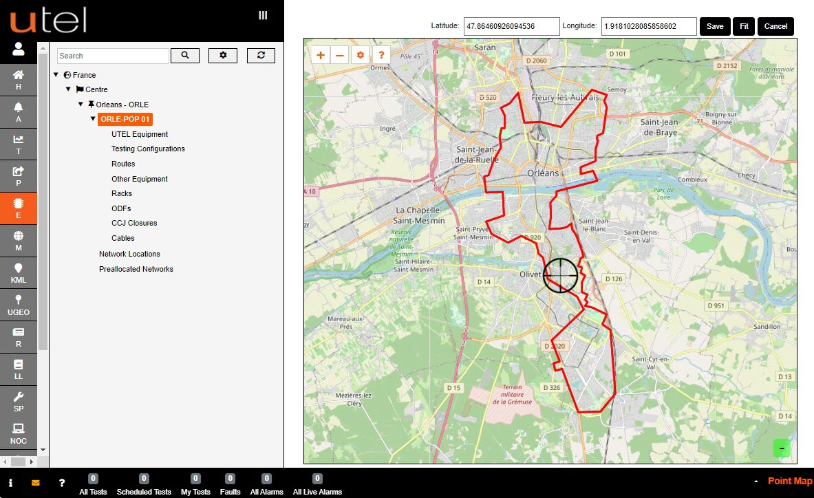
To centralize the page on the red parent area you are working within, click Fit.
By zooming, drag and drop the cross-hair target precisely to where the POP is located. As you move it around, you will see the latitude and longitude positions changing at the top of the screen.
This must be as accurate as possible.
This is the location of the OTDR and an inaccurate location will lead to incorrect mapping and potentially large-scale problems in the future.
Once the cursor is in position, click Save.
To cancel and go back to previous screen, click Cancel.