Select 'Capture Planning Zone' button located on the top of the map.
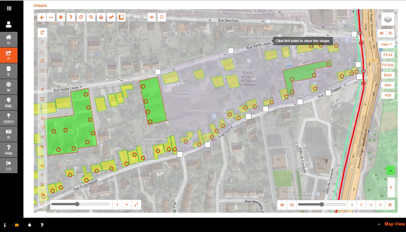
The Capture Planning Zone creation is a region so the same process is applied. Click points was used in this example.
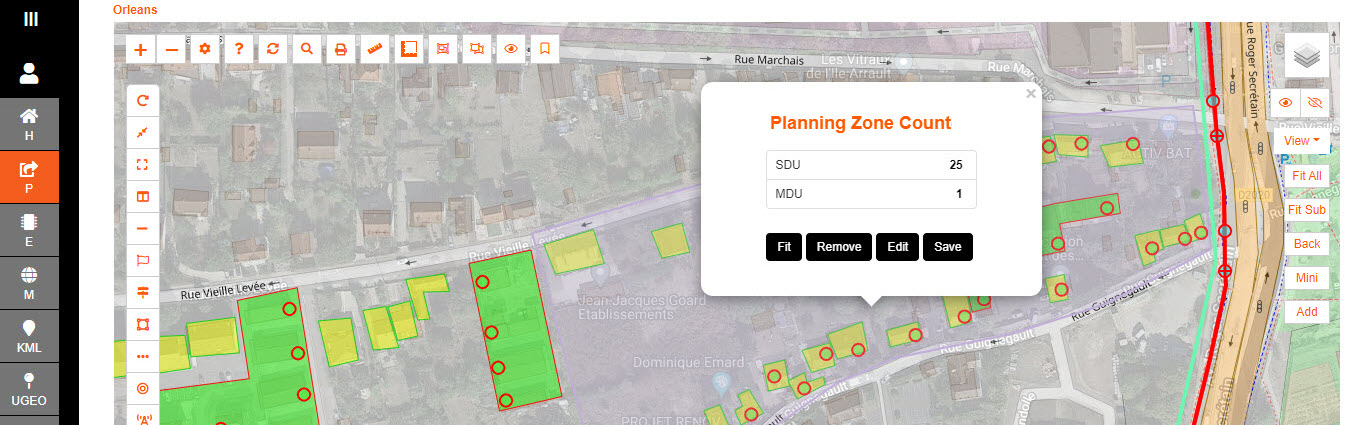
Once the polygon is closed then a pop up is presented indicating how many single and multiple dwelling units are captured within.
Edit the outline accordingly and the count is updated.
This tool can be used to capture the exact amount of houses a planning zone requires for optimum designing.
Save is an option to utilize the zone as a regular zone; where the civil's can be encapsulated within for ease of grouping.
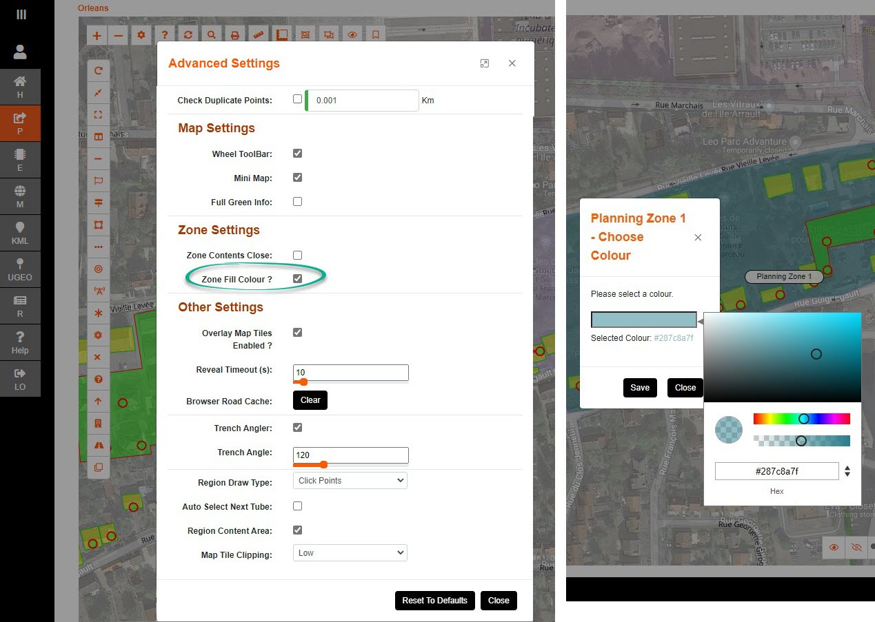
Advanced Map Settings has the option to 'colour' the items the same colour that is chosen for the zone to optimize the grouping.
Select the Zones 'Set Colour' button. Select the colour, and opacity, of the zone to allow it to be distinguished.